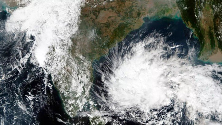
Bhubaneswar, Sep 18: A low-pressure area is likely to develop over the north Andaman Sea around the evening of September 19, and may gradually intensify as it moves towards the south Odisha–north Andhra Pradesh coasts, the India Meteorological Department (IMD) said in its latest weather update.
According to the IMD bulletin based on observations recorded at 8:30 am on Friday, an upper-air cyclonic circulation over north Thailand in the mid-tropospheric levels continues to persist over the region. The system is very likely to emerge over the north Andaman Sea during the next 24 hours.
Under the influence of this circulation, a low-pressure area is expected to form over the north Andaman Sea by the evening of September 19. The weather system is then likely to intensify gradually and move in a west-northwestward direction towards the south Odisha and north Andhra Pradesh coasts during the following three to four days.
The developing system is being closely monitored by meteorological authorities, particularly in view of its expected movement towards the eastern coast. Its eventual intensity, track and impact on rainfall activity will become clearer as the system develops over the Bay of Bengal.
The IMD is expected to issue further forecasts and weather warnings as the system evolves. Residents and authorities in Odisha and adjoining coastal areas are advised to keep track of official weather bulletins for updates on rainfall, wind conditions and the system’s movement.
The weather system could influence rainfall patterns across parts of the region in the coming days, depending on its subsequent development and trajectory.
About the Author