
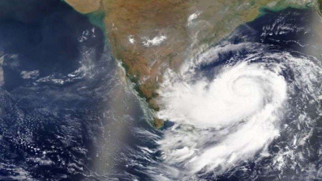
Bhubaneswar, Sep 21: A low-pressure area currently centred over the East-Central Bay of Bengal is moving west-northwestwards, although its intensification has so far remained slow. The weather system is likely to strengthen into a Depression by the evening of September 21, 2026, and may further intensify into a Deep Depression by the evening of September 22.
According to the forecast, the system is likely to move towards the Odisha coast and may cross the coast between Ganjam and Puri districts, near the Chilika region, during the night of September 23.
There is still some uncertainty regarding the exact landfall location and track of the system. The relatively slow intensification of the system could cause it to remain nearly stationary over southern Odisha and adjoining areas of north Andhra Pradesh.
The system is expected to change its direction of movement after landfall, initially moving northwards and subsequently northeastwards towards Jharkhand. A clearer assessment of the system’s landfall and movement is expected by the afternoon of September 22.
Under the influence of the system, heavy to very heavy rainfall is likely to continue in several parts of Odisha between September 21 and 23. The affected districts may include Puri, Jagatsinghpur, Kendrapara, Ganjam, Khurda, Cuttack, Gajapati, Rayagada, Kandhamal, Kalahandi, Nabarangpur, Bolangir, Dhenkanal, Angul, Nayagarh and Nuapada.
Extremely heavy rainfall is also possible in parts of Khordha, Cuttack and Nayagarh during the forecast period. From September 23 to 26, the zone of heavy rainfall is expected to gradually shift towards northern and western districts of Odisha.
The prolonged and intense rainfall may also increase the risk of flooding in the catchments of major rivers, including the Mahanadi, Brahmani, Subarnarekha and Budhabalanga.
Authorities and residents in vulnerable areas are advised to closely monitor official weather updates as the system’s intensity and track become clearer over the next 24 to 48 hours.
About the Author