
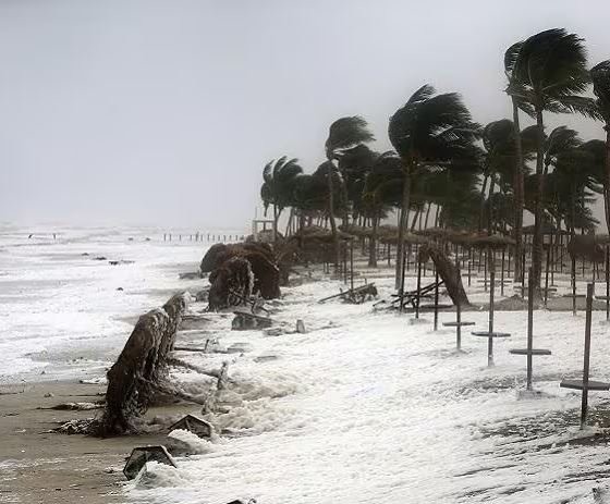
Bhubaneswar, Oct 27: A very severe cyclonic storm is likely to cause widespread damage to houses, power infrastructure, trees and standing crops across Odisha and neighbouring states, India Meteorological Department (IMD) Director General Dr Mrutyunjay Mohapatra warned on Tuesday.
Briefing reporters, Mohapatra said destructive winds and heavy to extremely heavy rainfall could affect Andhra Pradesh, Odisha, Chhattisgarh and Telangana, threatening settlements, infrastructure and agriculture.
Parts of the Andhra Pradesh coast, particularly the stretch between Bapatla and Visakhapatnam, could experience wind speeds of 90-120 kmph. Southern Odisha is likely to witness winds of 60-80 kmph, with gusts reaching 90 kmph after landfall.
Koraput, Nabarangpur, Malkangiri and Rayagada are among the Odisha districts expected to experience the cyclone’s impact as the system approaches the coast on October 28. Similar conditions are forecast in southern Chhattisgarh and parts of northeastern Telangana.
According to Mohapatra, the storm is expected to approach the Yanam region before moving northwestwards inland, affecting parts of southern Odisha, Chhattisgarh, Telangana and northern Andhra Pradesh. It is likely to weaken gradually while moving towards eastern Madhya Pradesh.
Rainfall has already begun in Odisha and Andhra Pradesh, with heavy to very heavy showers expected in several areas. Extremely heavy rainfall is also possible at isolated locations.
The cyclone could severely damage paddy and horticultural crops, including banana, papaya and drumstick. Mohapatra also warned of urban and riverine flooding, power disruptions and possible landslides in the Eastern Ghats, particularly in areas receiving intense rainfall.
About the Author